Station Diaries
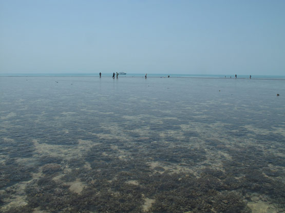
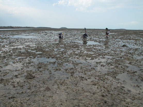
This page shows a timeline diary and photo galleries of four survey locations explored through this trip: Adele Island and Montgomery Reef (2009 survey) and will soon be showing Cassini island and Long Reef (2010 survey).
Adele Island (view photo gallery)
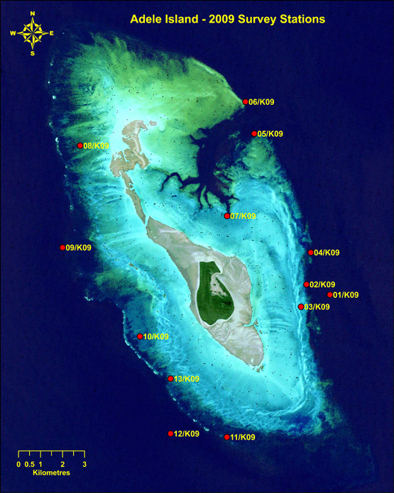
- Satellite imagery of the station locations on Adele Island.
- Image provided by WA Museum.
- Image copyright of WA Museum.
13/10/2009 - 12.50pm - Dive: Sublittoral Fore-Reef Slope
- Station:
- 1/K09
- Complexity Score:
- 2
- Station coordinates:
- S 15° 31.406', E 123° 12.032'
- Max-depth (msw):
- 20
- T-Depth (msw):
- 14
- Visibility (5, 10, 20m):
- 5
Patch reef shoreward of 1/K09: Shallow patch reef of small and large rocky outcrops on a sand slope of coarse coralline sand overlaid with fine silt. Larger outcrops have coalesced to form a seaward edge of the reef crest. These outcrops are vertical sided, ledged and undercut; covered in hard and soft corals.
14/10/2009 - 8:00am - Dive: Sublittoral Fore-Reef Slope
- Station:
- 2/K09
- Complexity Score:
- 2/3
- Station coordinates:
- S 15° 31.152', E 123° 11.743'
- Max-depth (msw):
- 14
- T-Depth (msw):
- 11
- Visibility (5, 10, 20m):
- 5
Patch reef shoreward of 1/K09: Shallow patch reef of small and large rocky outcrops on a sand slope of coarse coralline sand overlaid with fine silt. Larger outcrops have coalesced to form a seaward edge of the reef crest. These outcrops are vertical sided, ledged and undercut; covered in hard and soft corals.
14/10/2009 - 13:00pm - Intertidal: Mid-littoral Reef Platform
- Station:
- 3/K09
- Complexity Score:
- 1
- Station coordinates:
- S 15° 31.700', E 123° 11.611'
- Max-depth (msw):
- N/A
- T-Depth (msw):
- 0
- Visibility (5, 10, 20m):
- N/A
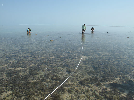
Inshore of 1 and 2/K09: Porous reef platform, shallow tidal pools and drainage channels with coarse coralline sand and gravel. Macro algae and small coral colonies dominate the reef tops with scattered turnable coral rubble evenly spread about. Large specmens of the giant clam, Tridacna squamosa are present in some of the pools.
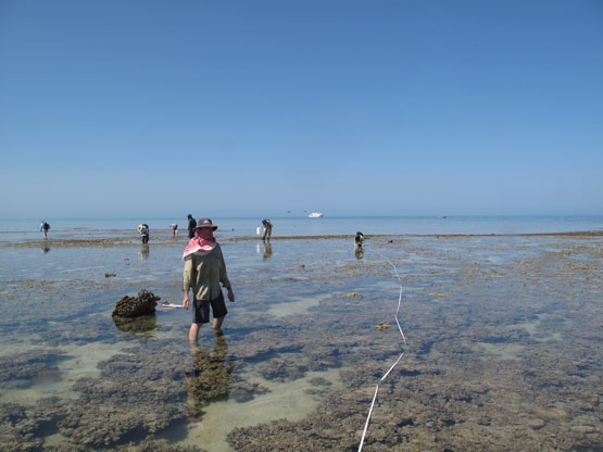
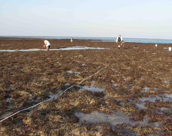
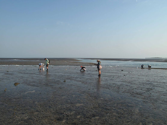
- Adele Island Station 3.
- Photo by Sue Morrison.
- Image copyright of WA Museum.
14/10/2010 - 15:15pm - Dive: Sublittoral Fore-Reef Slope
- Station:
- 4/K09
- Complexity Score:
- 2
- Station coordinates:
- S 15° 30.037', E 123° 11.852'
- Max-depth (msw):
- 15
- T-Depth (msw):
- 13
- Visibility (5, 10, 20m):
- 6
Vertical wall with encrusting corals and bare rock dusted with fine silt. Wall is ledged and undercut with a silty, rubble strewn slope continuing down from 16m. Transect was positioned on the wall.
15/10/2010 - 8:00am - Dive: Sublittoral Channel Slope
- Station:
- 5/K09
- Complexity Score:
- 3
- Station coordinates:
- S 15° 27.456', E 123° 10.463'
- Max-depth (msw):
- 15.5
- T-Depth (msw):
- 12
- Visibility (5, 10, 20m):
- 8
Edge of Frazer Inlet: Small and very large rocky outcrops with corals, hydroids and soft coals. Outcrops were deeply ledged and undercut. Between the outcrops small coral colonies and large coral rubble slabs lay scattered over the sediment, which is very fine (silt), but with coarser sands beneath.
15/10/2010 - 13:30pm - Dive: Sublittoral Channel Slope
- Station:
- 6/K09
- Complexity Score:
- 4
- Station coordinates:
- S 15° 26.676', E 123° 10.249''
- Max-depth (msw):
- 21
- T-Depth (msw):
- 12
- Visibility (5, 10, 20m):
- 8
Edge of Frazer Inlet: Large rocky outcrops forming a broken vertical wall, deeply ledged and undercut. To seaward lies another line of large outcrops forming a similar wall. General impression is of a long-reef spur and groove topography. Walls are covered with hard and soft corals with exposed rock dominating at the deeper depths (20m). Sediment is fine (silt) with deeper gullies having coarse coralline sand.
15/10/2010 - 15:15pm - Intertidal: Mid-littoral Reef Platform
- Station:
- 7/K09
- Complexity Score:
- 1
- Station coordinates:
- S 15° 29.474', E 123° 09.798'
- Max-depth (msw):
- N/A
- T-Depth (msw):
- 0
- Visibility (5, 10, 20m):
- N/A
Reef platform at head of Frazer Inlet: The platform is heavily etched with small drainage channels giving it a crumbly, porous appearance. Several low, widely spaced ridges run parrallel to the reef edge with long, rubble filled pools in between. The ridges give the impression of a series of corrugations that are long, low and wide. Turnable coral rubble is plentiful and the platform is covered with macro algae, Padina sp.
16/10/2010 - 8:30am - Dive: Mid-littoral Back Reef Slope
- Station:
- 8/K09
- Complexity Score:
- 1
- Station coordinates:
- S 15° 27.744', E 123° 06.201'
- Max-depth (msw):
- 6
- T-Depth (msw):
- 6
- Visibility (5, 10, 20m):
- 12
North west corner of reef. Reef pavement with a thin covering of coarse coralline sand, coral rubble and dominated by the macro algae, Sargassum. Small isolated coral outcrops are scattered about with a reasonable assemblage of echinoderms.
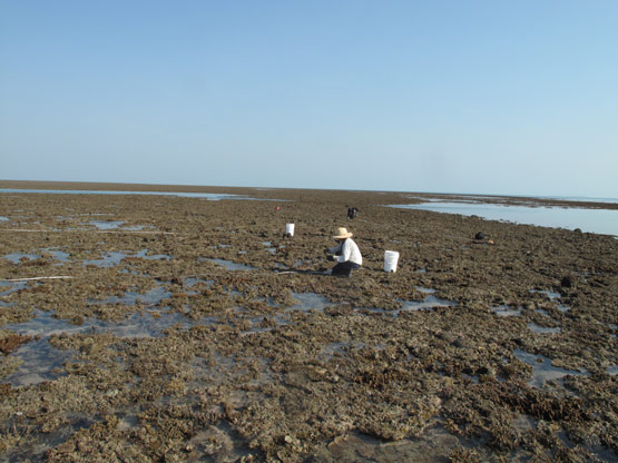
- Adele Island Station 8
- Photo by Clay Bryce.
- Image copyright of WA Museum.
16/10/2010 - 13:00pm - Dive: Sublittoral Fore-Reef Slope
- Station:
- 9/K09
- Complexity Score:
- 3
- Station coordinates:
- S 15° 30.248', E 123° 05.766'
- Max-depth (msw):
- 18
- T-Depth (msw):
- 12
- Visibility (5, 10, 20m):
- 10
Sloping wall of rock pavement shallowing to a series of large, low and flat rocky outcrops at the slope crest (12m). The outcrops appear to have coelesced with shallow channels that define their edges (i.e. running both parrallel and across the reef front). The channels are vertically sided and undercut with coarse coralline sand covered with fine silt. The outcrops are free of sand or silt and covered with soft and encrusting plate-coral with numerous colonies of bryozoa. The reef is swept by strong tidal currents as evidenced by these assemblages and lack of any sediment coating.
17/10/2010 - 8:00am - Dive: Mid-littoral Back Reef Slope
- Station:
- 10/K09
- Complexity Score:
- 1
- Station coordinates:
- S 15° 32.429', E 123° 07.663'
- Max-depth (msw):
- 3.5
- T-Depth (msw):
- 3.5
- Visibility (5, 10, 20m):
- 12
High energy zone: Current swept, cemented reef platform with many depressions leading to a labyrinth of under-platform tunnels. Depressions with coarse sand and coral rubble slabs. Live "coral nodules" of several species were evident in the depressions.
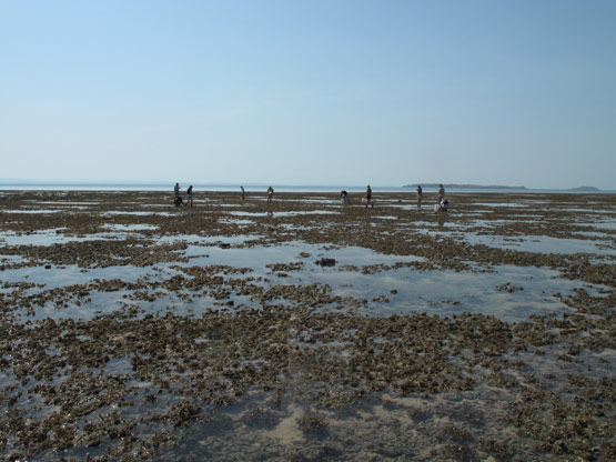
- Adele Island Station 10.
- Photo by Clay Bryce.
- Image copyright of WA Museum.
17/10/2010 - 13:00pm - Dive: Mid-littoral Back Reef Slope
- Station:
- 11/K09
- Complexity Score:
- 1
- Station coordinates:
- S 15° 34.895', E 123° 09.793'
- Max-depth (msw):
- 2.5
- T-Depth (msw):
- 2.5
- Visibility (5, 10, 20m):
- 10
Similar to 8/K09: Reef pavement with a thin covering of coarse coralline sand, coral rubble and dominated by the macro alga, Sargassum. Small isolated coral outcrops and coral rubble slabs were scattered about.
18/10/2010 - 8:00am - Dive: Sub-littoral Fore-Reef Slope
- Station:
- 12/K09
- Complexity Score:
- 4
- Station coordinates:
- S 15° 34.810', E 123° 09.440'
- Max-depth (msw):
- 11
- T-Depth (msw):
- 7.5
- Visibility (5, 10, 20m):
- 8
Large loosely packed rocky outcrops with encrusting coral cover. The outcrops have steep sides and are deeply undercut and ledged. As a geomorphic unit they create a broken rampart in front of the reef platform. The spaces in between the outcrops form a labyrinth of white sandy channels free of rubble and coral debris. Larger areas of sand have large, widely spaced sand ripples - evidence of rolling surf.
18/10/2010 - 13:30pm - Dive: Sub-littoral Fore-Reef Slope
- Station:
- 13/K09
- Complexity Score:
- 4
- Station coordinates:
- S 15° 33.464', E 123° 08.041'
- Max-depth (msw):
- 17
- T-Depth (msw):
- 11
- Visibility (5, 10, 20m):
- 8
Similar to 12/K09 except for the presence of smaller sand ripples and the covering of fine silt over all but the very tops of the larger outcrops.
Montgomery Reef (view photo gallery)
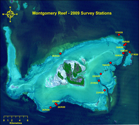
- Satellite imagery of the station locations on Montgomery Reef.
- Image provided by WA Museum.
- Image copyright of WA Museum.
19/10/2009 - 05:30am - Intertidal: Lower-littoral Fore-Reef Ramp
- Station:
- 14/K09
- Station coordinates:
- S 15° 53.815, E 124° 19.531'
- Max-depth (msw):
- N/A
- T-Depth (msw):
- 0
- Visibility (5, 10, 20m):
- N/A
Patch reef: Rocky outcrop with vertical sides that are deeply undercut and ledged to seaward. Outcrop slopes back to showeward to sand and broken ground of scattered, smaller outcrops. Coarse coralline sands in interspaces - site was dusted with very fine silt. Encrusting corals, seawhips and hydroids.
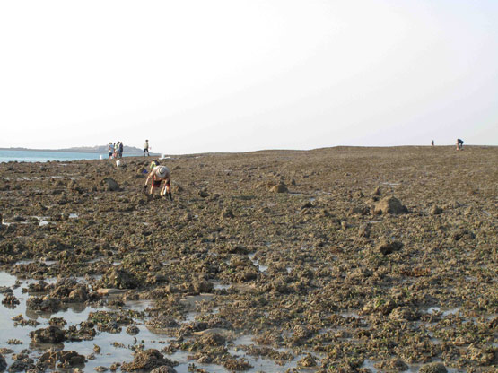
- Montgomery Reef Station 14.
- Photo by Clay Bryce.
- Image copyright of WA Museum.
19/10/2009 - 06:45am - Intertidal: Mid-littoral Reef Terrace
- Station:
- 15/K09
- Station coordinates:
- S 15° 53.815, E 124° 19.531'
- Max-depth (msw):
- N/A
- T-Depth (msw):
- 0
- Visibility (5, 10, 20m):
- N/A
Patch reef shoreward of 1/K09: Shallow patch reef of small and large rocky outcrops on a sand slope of coarse coralline sand overlaid with fine silt. Larger outcrops have coalesced to form a seaward edge of the reef crest. These outcrops are vertical sided, ledged and undercut; covered in hard and soft corals.
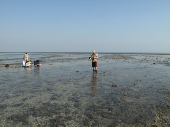
- Montgomery Reef Station 15.
- Photo by Clay Bryce.
- Image copyright of WA Museum.
19/10/2009 - 16:30pm - Intertidal: Top of Mid-littoral Fore-Reef Ramp
- Station:
- 16/K09
- Station coordinates:
- S 15° 55.143, E 124° 17.731'
- Max-depth (msw):
- N/A
- T-Depth (msw):
- 0
- Visibility (5, 10, 20m):
- N/A
Biodiversity collection site: This was due to the tide still running and loss of daylight. Steep forward ramp leading to a terrace with wide and raging tidal drainage channels on either side. Terrace had long-shore ridges of rubble, Rhodolith and sand. Differential deposition was evident with the lighter sand being deposited along the front edge of the ridges with the back edges damming the pools. Small isolated coral colonies were numerous, especially in the pools.
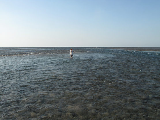
- Montgomery Reef Station 16.
- Photo by Clay Bryce.
- Image copyright of WA Museum.
20/10/2009 - 05:45am - Intertidal: Lower-littoral Fore-Reef Terrace
- Station:
- 17/K09
- Station coordinates:
- S 15° 51.323', E 124° 18.875'
- Max-depth (msw):
- N/A
- T-Depth (msw):
- 0
- Visibility (5, 10, 20m):
- N/A
Low peninsula forming a flat reef platform constiting of consolidated rock and coral rubble with a dense covering of Sargassum. Tidal pools are long-shore, with coarse sand and coral rubble.
- Montgomery Reef Station 17.
- Photo by Clay Bryce.
- Image copyright of WA Museum.
20/10/2009 - 07:15am - Intertidal: Mid-littoral Fore-Reef Ramp
- Station:
- 18/K09
- Station coordinates:
- S 15° 52.588, E 124° 19.793'
- Max-depth (msw):
- N/A
- T-Depth (msw):
- 0
- Visibility (5, 10, 20m):
- N/A
Sculptured, brittle reef platform with many interlocking pools with dead coral slabs. Many small colonies of hard and soft corals around the edge of the pools, which are undercut and floored with coarse, coralline sand.
- Montgomery Reef Station 18.
- Photo by Clay Bryce.
- Image copyright of WA Museum.
20/10/2009 - 08:20am - Intertidal: Mid-littoral Reef Terrace
- Station:
- 19/K09
- Station coordinates:
- S 15° 52.727, E 124° 19.602'
- Max-depth (msw):
- N/A
- T-Depth (msw):
- 0
- Visibility (5, 10, 20m):
- N/A
Flat consolidated reef platform with cropped algae, sand and small coral colonies. Pools were shallow, filled with Rhodolith nodules (purple and nodulose), coral rubble and sand. This site was separated from the previous (18/K09) by a band of coral rubble that did not appear to be high enough to form a rampart.
- Montgomery Reef Station 19.
- Photo by Clay Bryce.
- Image copyright of WA Museum.
21/10/2009 - 07:40am - Intertidal: Mid-littoral Fore-Reef Ramp
- Station:
- 20/K09
- Station coordinates:
- S 15° 53.895, E 124° 10.901'
- Max-depth (msw):
- N/A
- T-Depth (msw):
- 0
- Visibility (5, 10, 20m):
- N/A
Steep consolidated reef ramp, with a coating of fine gray silt and cut by fast flowing drainage channels. Ramp face is of bare, pitted "beach rock" with many hard and soft coral colonies, especially where the drainage channels cut the face. Base of ramp had a tidal moat contained to seaward by by sand flats. Sand flats were large and bisected by fast flowing tidal channles. The ramp rose to a flat, terraced reef-platform, which did not appear to completely drain or stop flowing. On the terrace, macro-algae, small patches of sparse seagrass (Thalassia) and clean, coralline sand dominated. Transects were laid out on the terrace.
- Montgomery Reef Station 20.
- Photo by Clay Bryce.
- Image copyright of WA Museum.
22/10/2009 - 06:34am - Intertidal: Mid-Littoral Channel Ramp
- Station:
- 21/K09
- Station coordinates:
- S 15° 57.582, E 124° 16.144'
- Max-depth (msw):
- N/A
- T-Depth (msw):
- 0
- Visibility (5, 10, 20m):
- N/A
Steep consolidated pavement with algal turf, small tidally bossed coral colonies - aspect was of a smoorth yet porous reef. Lower littoral section of station had formed a sand, coral and coral rubble bench, which was not repeated along the channel with any consistancy.
- Montgomery Reef Station 21.
- Photo by Clay Bryce.
- Image copyright of WA Museum.
22/10/2009 - 07:47am - Intertidal: Mid-Littoral Containment
- Station:
- 22/K09
- Station coordinates:
- S 15° 56.659, E 124° 16.004'
- Max-depth (msw):
- N/A
- T-Depth (msw):
- 0
- Visibility (5, 10, 20m):
- N/A
Channelled ramp extended to a terrace with long shore containment ridge (116 m wide) of sand, coral rubble and Rhodolith nodules. Station was established lagoon side of the containment. Limestone pavement with sand and coral rubble, live corals and macro-algae. Pavement gave way to a series of deeper elongated pools (running long-shore). Site was flooded but may dry on a spring tide.
- Montgomery Reef Station 22.
- Photo by Clay Bryce.
- Image copyright of WA Museum.
22/10/2009 - 09:05am - Intertidal: Subtidal Lower Terrace
- Station:
- 23/K09
- Station coordinates:
- S 15° 58.089, E 124° 16.918'
- Max-depth (msw):
- N/A
- T-Depth (msw):
- 0
- Visibility (5, 10, 20m):
- N/A
Flat lower-terrace of coral rubble and macro-algae with interspaces of coralline sand that at checked points was approximately 10 cm deep. Small colonies of coral were common but more numerous towards the channel. Possibility that this zone may be part of the main lagoon.
- Montgomery Reef Station 23.
- Photo by Clay Bryce.
- Image copyright of WA Museum.
23/10/2009 - 07:27am - Intertidal: Mid-littoral Fore-Reef Ramp
- Station:
- 24/K09
- Station coordinates:
- S 16° 00.865, E 124° 10.389'
- Max-depth (msw):
- N/A
- T-Depth (msw):
- 0
- Visibility (5, 10, 20m):
- N/A
A gently sloping ramp, which extended to a terraced and porous reef platform. The site was bordered by fast running drainage channels and the lower areas were dusted with a fine silt. The slope was scatterd with tidal pools.
- Montgomery Reef Station 24.
- Photo by Clay Bryce.
- Image copyright of WA Museum.
23/10/2009 - 08:32am - Intertidal: Mid-littoral Terrace containment
- Station:
- 25/K09
- Station coordinates:
- S 16° 00.715, E 124° 10.246'
- Max-depth (msw):
- N/A
- T-Depth (msw):
- 0
- Visibility (5, 10, 20m):
- N/A
Flooded and terraced reef platform leading to a long-shore Rhodolith, sand and coral rubble containment ridge. The platform and containment ridge were coverd with macro algae (Sargassum). The contained lagoon was shallow with many sand ridges backed by deeper troughs. Dead coral and giant clams may indicate a very motile environment where moving sand ridges periodically cover the live sessile biota then expose the dead skeletons.
- Montgomery Reef Station 25.
- Photo by Clay Bryce.
- Image copyright of WA Museum.
23/10/2009 - 09:58am - Intertidal: Mid-littoral Lower Terrace
- Station:
- 26/K09
- Station coordinates:
- S 16° 01.240, E 124° 09.547'
- Max-depth (msw):
- N/A
- T-Depth (msw):
- 0
- Visibility (5, 10, 20m):
- N/A
A gently sloping ramp of consolidated rock and rubble with macro algae (Sargassum). Crest of the ramp acts as a containment ridge for a flooded lagoon. The contained lagoon was shallow with many sand ridges backed by deeper troughs. Dead coral and giant clams may indicate a very motile environment where moving sand ridges periodically cover the live sessile biota then expose the dead skeletons.
- Montgomery Reef Station 26.
- Photo by Clay Bryce.
- Image copyright of WA Museum.
24/10/2009 - 07:00am - Intertidal: Mid-littoral Lower Terrace
- Station:
- 27/K09
- Station coordinates:
- 15° 53.700', 124° 20.340'
- Max-depth (msw):
- N/A
- T-Depth (msw):
- 0
- Visibility (5, 10, 20m):
- N/A
Consolidated reef platform with a small amount of coral rubble and tidal pools. Algal turf and cropped macro-algae cover the platform but the rocks are bare nearest to the water.
- Montgomery Reef Station 27.
- Photo by Clay Bryce.
- Image copyright of WA Museum.

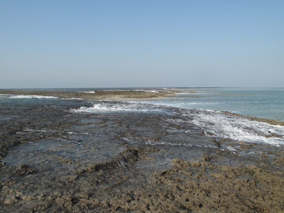
Videos from the field
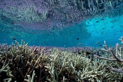
- Offshore atoll coral
© Western Australian Museum
Photograph by Clay Bryce, Western Australian Museum